Responsible Exploration. Safer Operations. Verifiable Environmental Compliance Powered by Satellite Intelligence.
Mining operations require reliable monitoring to support responsible exploration, efficient operations, environmental protection, and compliance. Satellite technology enables wide-area, frequent monitoring of mining sites and surrounding environments, helping identify risks, track changes, and improve decision-making.
From early-stage exploration through active operations and post-mining rehabilitation, Rada combines high-resolution imagery with AI-powered geospatial analytics to give mining companies a continuous, evidence-based view of their sites without relying on frequent, costly field inspections.
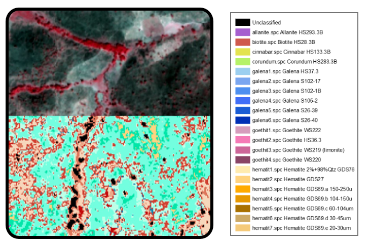
Identify promising mineral-rich areas before fieldwork begins using high-resolution satellite imagery and geospatial analysis. Our technology detects geological features, surface alterations, and structural patterns associated with mineral deposits, helping mining companies prioritize exploration targets, reduce unnecessary field surveys, lower exploration costs, and make faster, data-driven decisions.
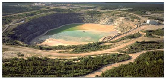
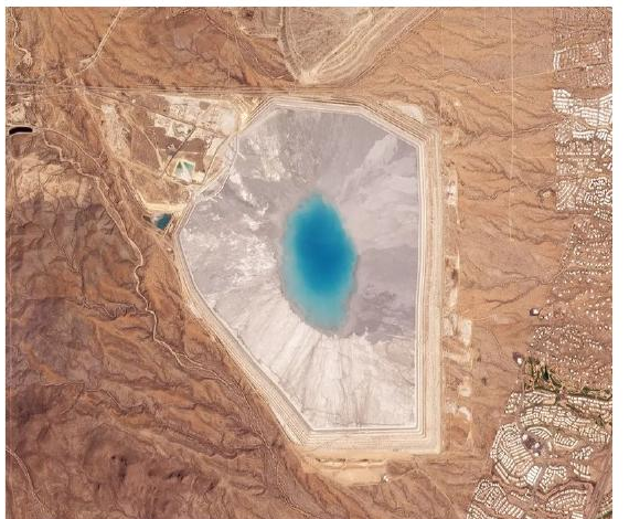
Monitor tailings storage facilities remotely to improve safety and reduce environmental risks. Satellite technology continuously tracks changes in tailings ponds, surrounding water bodies, and vegetation health, helping detect early signs of seepage, instability, or environmental impacts before they become major incidents. This enables proactive risk management and supports safer mining operations.
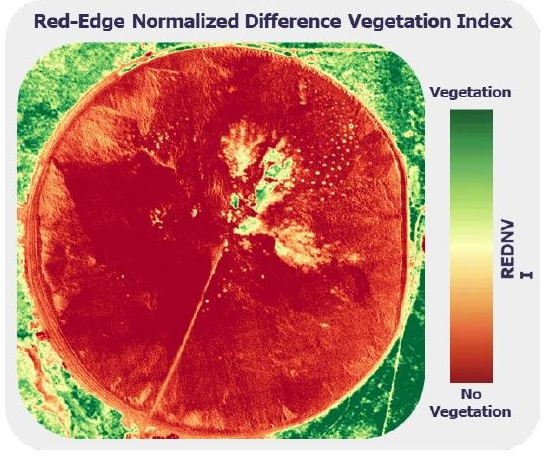
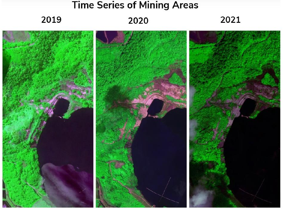
Protect the environment while maintaining compliance through continuous satellite monitoring. We track vegetation loss, land disturbance, water body changes, and environmental degradation around mining sites, providing timely insights that support sustainable mining practices, environmental reporting, and regulatory compliance without frequent field inspections.
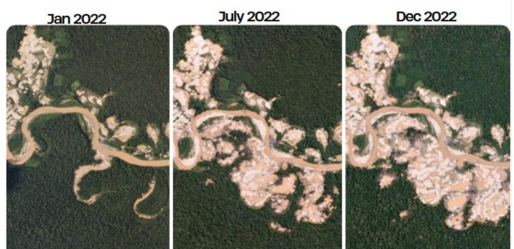
Safeguard mining assets by detecting unauthorized activities inside and around licensed mining areas. High-resolution satellite imagery enables regular monitoring of mining leases to identify illegal mining, land encroachment, and surrounding land-use changes, allowing companies to respond quickly, protect valuable resources, and strengthen regulatory compliance.
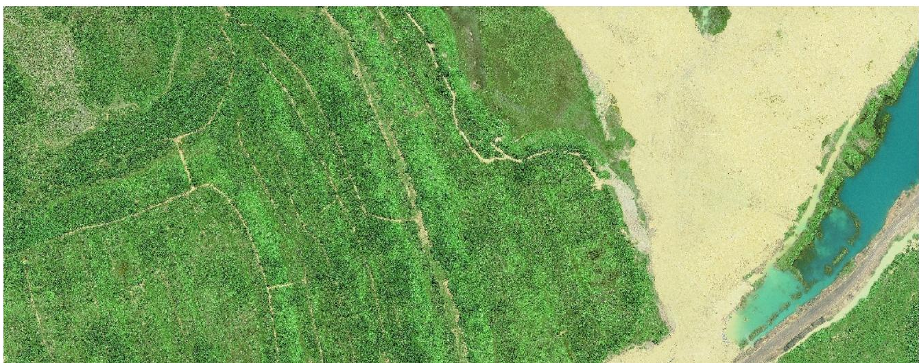
Measure the progress of mine rehabilitation using satellite imagery throughout the restoration process. Our solution monitors vegetation recovery, land restoration activities, and site conditions over time, providing objective evidence to verify rehabilitation efforts, demonstrate environmental compliance, and support ESG reporting requirements.
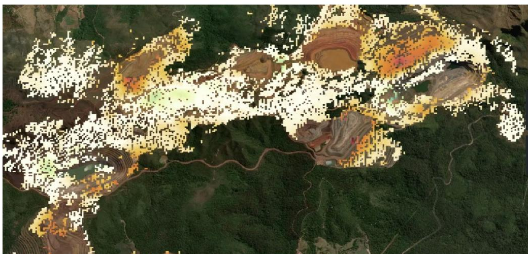
Improve operational safety through continuous satellite-based monitoring of potential hazards. We detect ground movement, slope instability, and areas at risk of failure, helping mining operators identify emerging threats early, prioritize inspections, and take preventive action before hazards impact operations or worker safety.
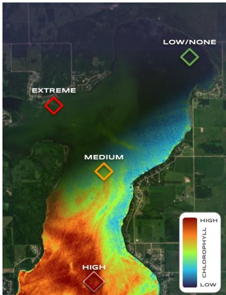
Monitor the health of water resources surrounding mining operations using advanced satellite analytics. Our solution assesses water quality indicators, sediment movement, turbidity, aquatic vegetation, and signs of acid mine drainage, providing early insights into environmental impacts while supporting responsible water management and ecosystem protection.
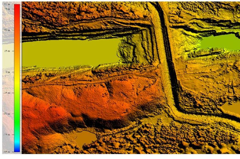
Support efficient mine planning and operational management with up-to-date satellite imagery. Our services provide accurate site information for planning mine expansion, designing infrastructure, assessing site conditions, monitoring operational progress, and optimizing haul road and waste dump planning, reducing uncertainty throughout the mining lifecycle.
Join mining companies using Rada to explore responsibly, operate safely, and prove environmental compliance.
Contact Our Mining Team